Northbound: (mm 2624) You just crossed over to the west side of Harts Pass Peak. The trail now points directly at Slate Peak and the ruins of the fire look out that once stood there. It's 3.8 miles away and 1,110 higher.
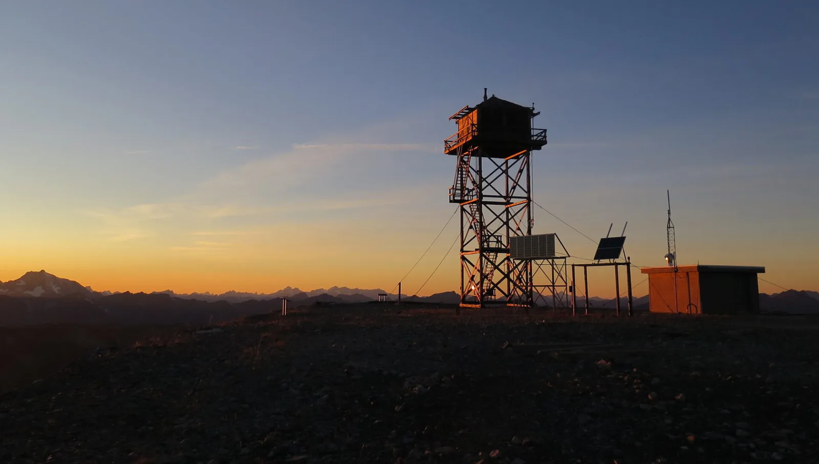
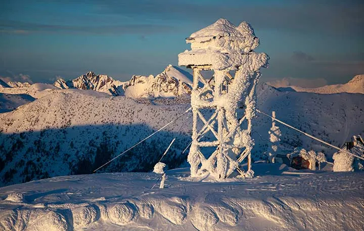
At 7,440′, Slate Peak Lookout was the 2nd highest fire lookout in Washington State, located at the end of the highest road in the State. (The ruins of the highest lookout is on Mt Adams.)
In 1924 the lookout was first constructed as a gable roof cupola.
In 1926, the top 40′ of Slate’s summit was blasted away by the Department of Defense to prepare for a radar station that was never built.
In 1954 the new lookout and scaffolding was moved to Slate Peak from Leecher Mountain. At 40' it matched the height of the original lookout.
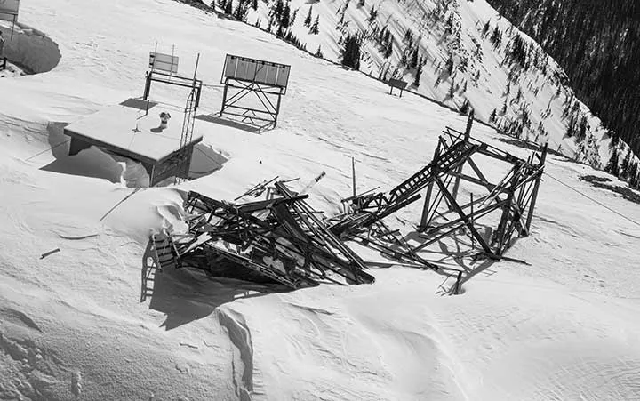
The lookout collapsed under heavy snow and wind in early March 2026. The collapse was first discovered by Kiera Nagrane, helicopter pilot for the ski company that operates the yurt visible from the PCT at Windy Pass.
The original 1924 lookout:
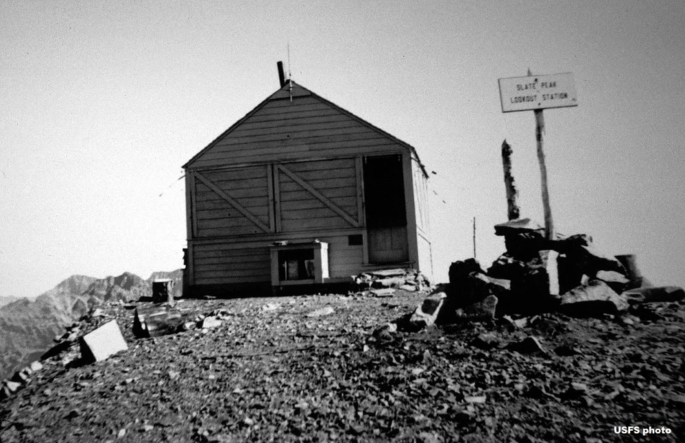
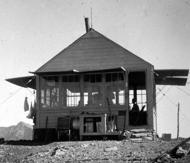 The new 1954 lookout:
 The first image of the collapsed lookout (March 2026):